| Start | (-33.7096169,150.3763989) |
| Mode | Bus Car (There is free parking available.) Train |
| Turn map | Directions & comments |
|---|---|
 |
|
 |
|
 |
|
 |
|
 |
|
 |
|
 |
|
 |
W:katoombarsl.com.au
We-Su 12:00-14:00,17:30-20:00 |
 |
|
 |
|
 |
After another 250 m (at the intersection of Armstrong Street & Falls Road) turn right, to head along Armstrong Street (a residential road).
|
 |
|
 |
|
 |
|
 |
At the intersection of Valley of the Waters Track & Nature Track turn right, to head along Valley of the Waters Track.
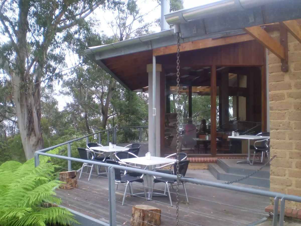 Conservation Hut is a small cafe perched above the Valley of the Waters, Blue Mountains National Park. The hut was opened in 1963 as a meeting place for the local conservation movement. Rebuilt, Conservation Hut opened as a cafe in 1993, serving breakfast, lunch and dinner, seven days a week. Around the Conservation Hut is a small parking area, public toilets, picnic shelters, town water and B&B's. For further information or bookings call (02) 4757 3827.
|
 |
|
 |
|
 |
The starting point of an optional sidetrip. An optional side trip to Queen Victoria Lookout. To start this optional side trip continue straight here. On returning from this side trip turn left when you get back to this intersection. Details below.
|
 |
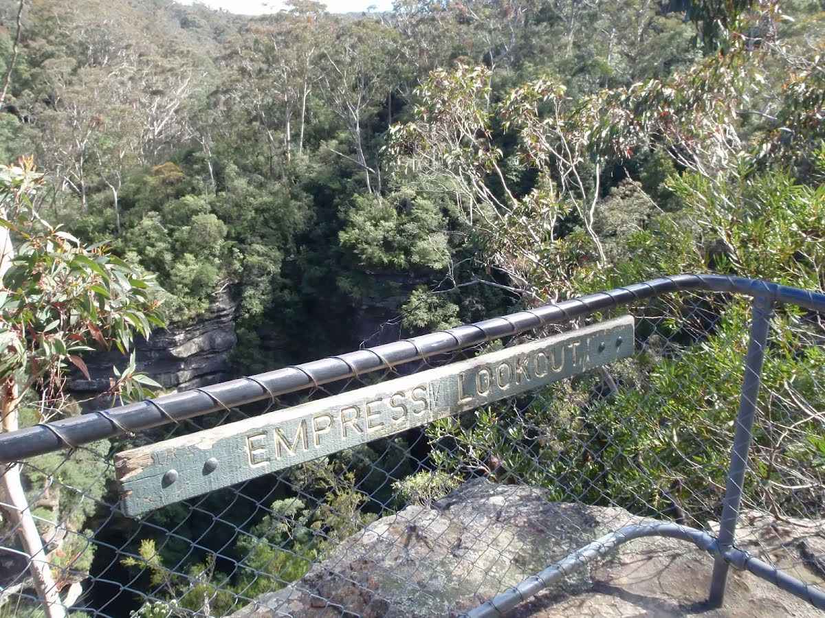 Empress Lookout is a fenced and signposted lookout, perched on a sandstone overhang above the Valley of the Waters Creek. There is a view down to part of the Empress Falls and into the canyon. The views are filtered through the surrounding trees. It makes for a good spot to catch your breath when walking into, or out of, the Valley of the Waters.
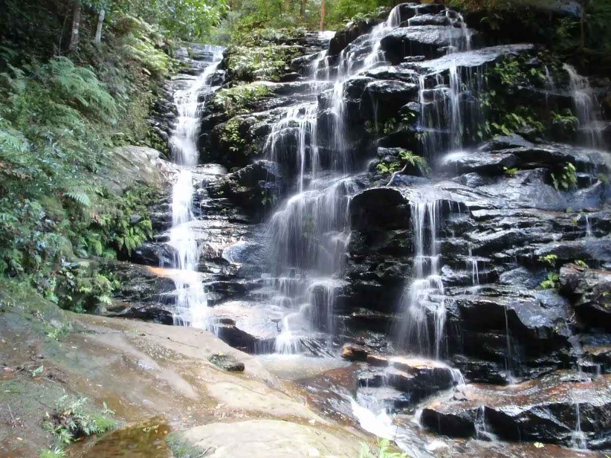 Sylvia Falls on the Valley of the Waters Creek is a lovely tall cascade. The falls are in a deep sandstone canyon with mossy walls. The stairs and handrail pass closely to these falls, helping walkers get nice and close. From near the top of the falls, there is a great view down the valley looking between the canyon walls.
|
 |
After another 90 m (at the intersection of Nature Track & Valley of the Waters Track) veer right, to head along Nature Track.
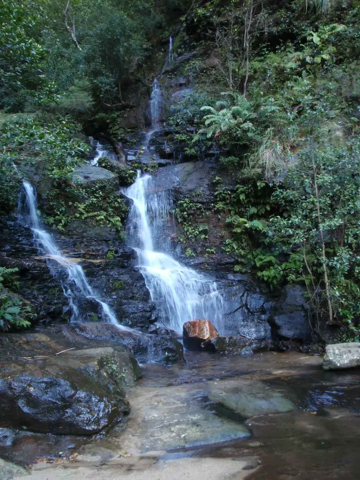
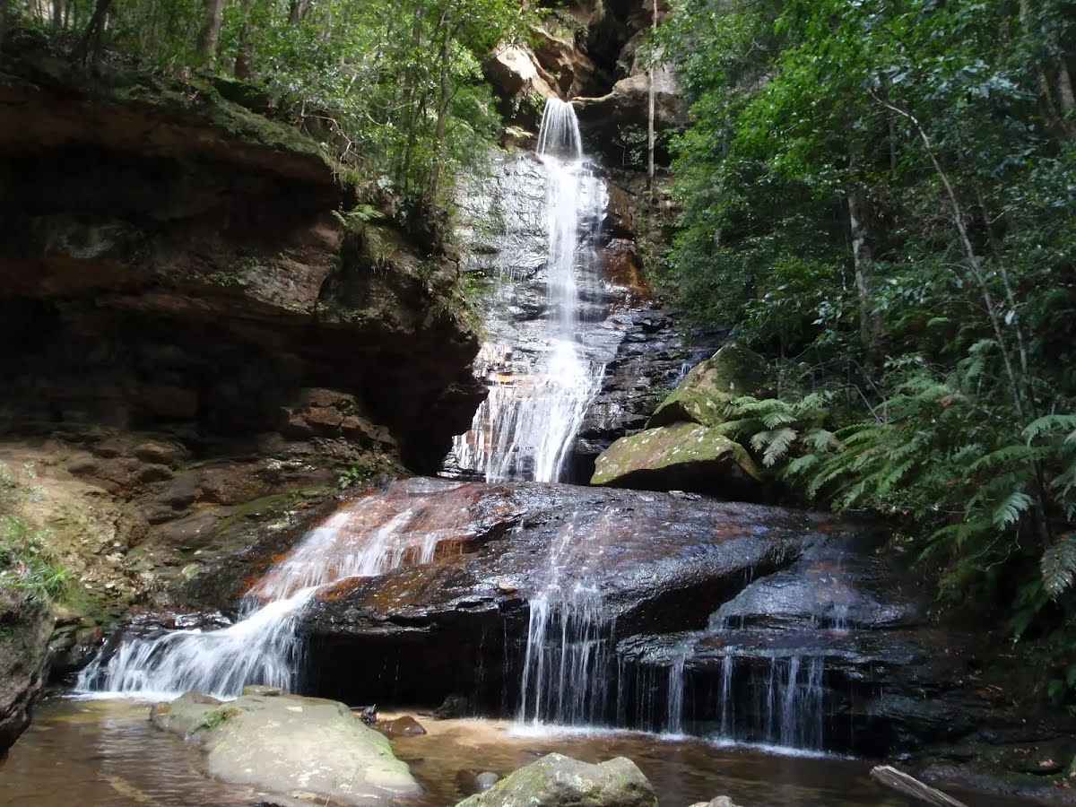 Empress Falls is a spectacular waterfall in the Valley of the Waters. The Valley of the Water Creek comes out of the slot in the cliff and tumbles down a series of cliffs to a sandy pool. The fall is the site of the last abseil in a popular canyon, making a great site for walkers in the area. Stepping stones help walkers cross below the falls. There is a small overhang next to the falls, giving the area shade and offering a great place to rest.
|
 |
After another 80 m (at the intersection of Nature Track & Grand Cliff Top Track) turn right, to head along Nature Track.
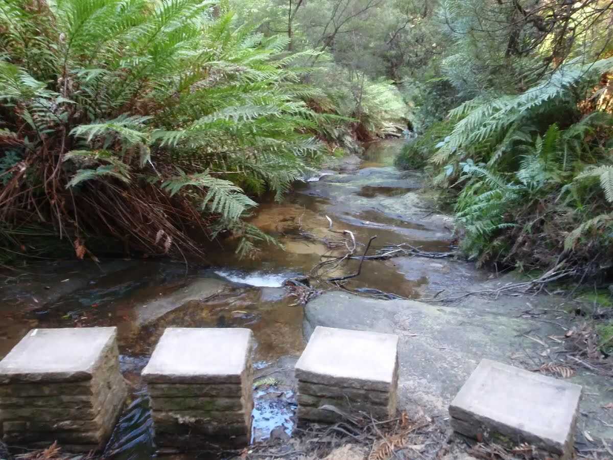 Lillian's Glen is a moss and fern filled section on the 'Valley of the Waters' Creek (where the Nature Track crosses the creek, south of Edinburgh Castle Rock). There are stepping stones to help cross the creek. Lillian's Glen is a great spot to rest and enjoy the area, especially on warmer days. For the sure-footed, a short clamber upstream to Asmodeus Pool at the bottom of a waterfall, is worthwhile - a very nice spot at the end of a narrow canyon.
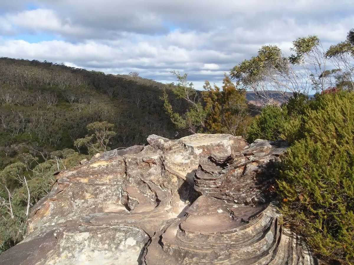 Edinburgh Castle Rock is a signposted, unfenced viewpoint on the Nature Track, in the Blue Mountains National Park. The rock platform has an interesting formation, with an uneven surface of circular lines. From Edinburgh Castle Rock, there is a view left, up the valley towards the houses on the ridge. Looking right, down the Valley of the Waters, it is possible to see the escarpment of Kings Tablelands.
|
 |
|
 |
|
 |
After another 100 m (at the intersection of Armstrong Street & Valley Road) continue straight, to head along Armstrong Street (a residential road).
|
 |
|
 |
|
 |
|
 |
|
 |
|
 |
|
 |
|
 |
|
 |
|
 |
|
 |

|
|
Class 4/6 Hard track |
|---|---|
| Length | 6.8 km |
| Time | 2 h 30 min to 3 h |
| Quality of track | Formed track, with some branches and other obstacles (3/6) |
| Gradient | Very steep (4/6) |
| Signage | Directional signs along the way (3/6) |
| Infrastructure | Limited facilities, not all cliffs are fenced (3/6) |
| Experience Required | Some bushwalking experience recommended (3/6) |
| Weather | Storms may impact on navigation and safety (3/6) |
| Item | From Start | Name & link to notes |
|---|---|---|
Seat
| 105 m | [seat] |
Toilet
| 165 m | [toilet] |
Toilet
| 480 m | [toilet] |
Toilet
| 2.7 km | [toilet] |